Trail Walking La Palud-sur-Verdon - Rando Barbin-Palud-Bastidon - Photo
 Fab-Oz
Fab-Oz

User

© OpenStreetMap contributors
Length
Length
16.6 km
Max alt
Max alt
1383 m
Uphill gradient
Uphill gradient
906 m
Km-Effort
Km-Effort  
29 km
Min alt
Min alt
707 m
Downhill gradient
Downhill gradient
919 m
Boucle
Boucle
Yes
Creation date :
2021-06-18 08:55:10.076
Updated on :
2021-06-20 07:25:34.175

(0 Reviews)

Walking
Walking
5h08
Difficulty : Medium

Scan this QR Code to open this trail in the SityTrail application

FREE GPS app for hiking

Logo SityTrail SityTrail

IGN / Geographical institutes

Download SityTrail from the App Store Download SityTrail from Google Play

Logo SityTrail SityTrail World

The world is yours!

Download SityTrail from the App Store Download SityTrail from Google Play Download SityTrail on Huawei AppGallery

About

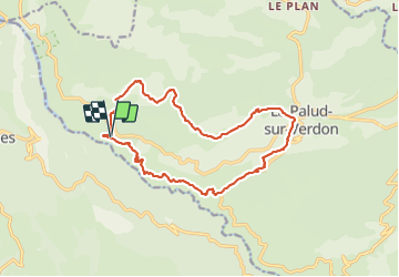
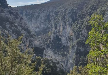
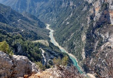
Trail Walking of 16.6 km to be discovered at Provence-Alpes-Côte d'Azur, Alpes-de-Haute-Provence, La Palud-sur-Verdon. This trail is proposed by Fab-Oz.

Description

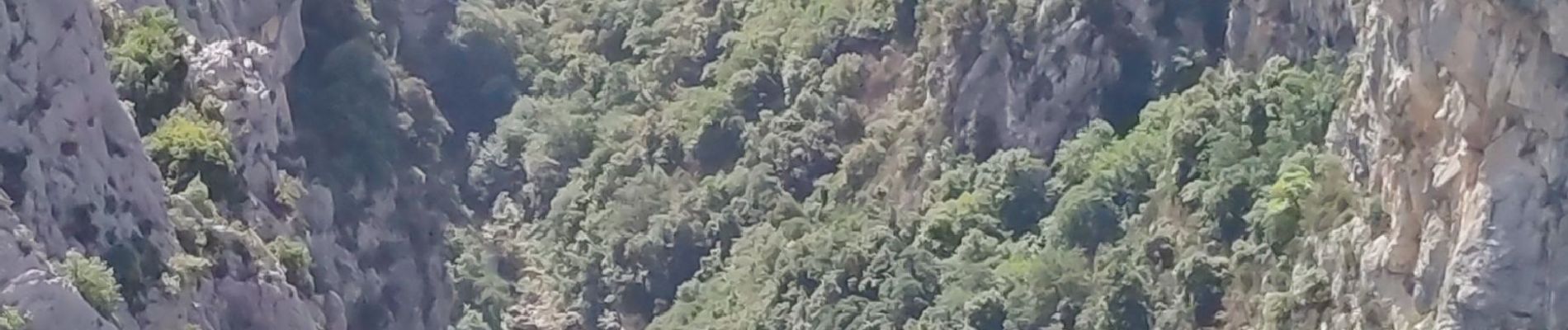
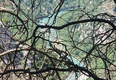
Au départ du Belvédère du Maireste, la partie la plus difficile est la montée sur le plateau de Barbin (3 km). Ensuite on rejoint le sommet Adrech de Barbin, puis on descend sur Palud-sur-Verdon.
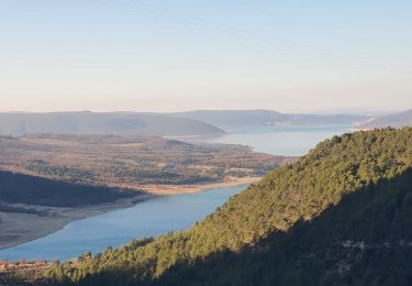
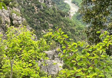
La dernier partie est très sympa par le Sentier du Bastidon pour rejoindre notre point de départ.

Elevation profile

Photos

Positioning

Country:
France
Region :
Provence-Alpes-Côte d'Azur
Department/Province :
Alpes-de-Haute-Provence
Municipality :
La Palud-sur-Verdon
Location:
Unknown
Start:(UTM)
281309 ; 4850552 (32T) N.

Trails nearby

Trail Walking Aiguines - 25-07-2023 Le Grand Margès retour par le cirque de Vaumale - Photo
Walking
GUIDE
Kargil

Walking

Very difficult
Aiguines, Provence-Alpes-Côte d'Azur, Var, France
17 km | 31 km-effort
7h 5min
Yes
Trail Walking Moustiers-Sainte-Marie - 2023-02-14 Les grottes de Saint Maurin  - Photo
Walking
GUIDE
Kargil

Walking

Easy
Moustiers-Sainte-Marie, Provence-Alpes-Côte d'Azur, Alpes-de-Haute-Provence, France
7.5 km | 12.2 km-effort
4h 11min
Yes
Trail Walking La Palud-sur-Verdon - bastidon - Photo
Walking
xav34830

Walking

Medium
(1)
La Palud-sur-Verdon, Provence-Alpes-Côte d'Azur, Alpes-de-Haute-Provence, France
18.4 km | 33 km-effort
Unknown
Yes
Trail Walking La Palud-sur-Verdon - Sentier des Pêcheurs - Photo
Walking
frizou83

Walking

Easy
(2)
La Palud-sur-Verdon, Provence-Alpes-Côte d'Azur, Alpes-de-Haute-Provence, France
5.8 km | 10.3 km-effort
2h 30min
Yes
Trail Walking Aiguines - aiguines - Photo
Walking
mailis

Walking

Very easy
(2)
Aiguines, Provence-Alpes-Côte d'Azur, Var, France
6.6 km | 10.8 km-effort
2h 35min
Yes
Trail Walking La Palud-sur-Verdon - 2024-06-02 Bastidon - Graou - Photo
Walking
GUIDE
Kargil

Walking

Very difficult
La Palud-sur-Verdon, Provence-Alpes-Côte d'Azur, Alpes-de-Haute-Provence, France
16.8 km | 29 km-effort
6h 34min
Yes
Trail Walking Aiguines - Grand Marges Gorges Verdon réel - Photo
Walking
jouans

Walking

Very difficult
Aiguines, Provence-Alpes-Côte d'Azur, Var, France
18 km | 32 km-effort
5h 48min
Yes
Trail Walking Moustiers-Sainte-Marie - Plein Voir  - Photo
Walking
aubr

Walking

Difficult
Moustiers-Sainte-Marie, Provence-Alpes-Côte d'Azur, Alpes-de-Haute-Provence, France
9.3 km | 17.8 km-effort
4h 0min
Yes
Trail Walking La Palud-sur-Verdon - 2023-03-24 Bastidon - Ravin du Brusc - Photo
Walking
GUIDE
Kargil

Walking

Difficult
La Palud-sur-Verdon, Provence-Alpes-Côte d'Azur, Alpes-de-Haute-Provence, France
13.3 km | 25 km-effort
5h 19min
No


Close
My subscriptions